WEATHER
Anogeia
Light Showers
11°C
Wind: 15 Southwest
Rethymno
16°C
Wind: 27 West
Spili
14°C
Wind: 06 West
Fragma Potamon
17°C
Wind: 13 West
courtesy of: www.meteo.gr


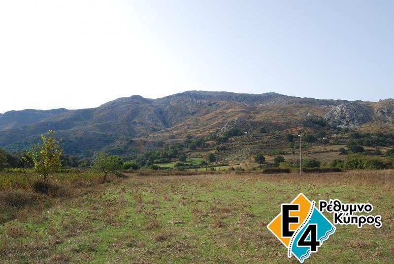
Argiroupoli - Agouseliana
Length: 23 km
Estimated time: 7 - 8 hours
Suggested period: January - December
Difficulty: Relatively easy
Summary of route
ARGIROUPOLI - KATO POROS
In order to continue our way from Argiroupoli towards the east, we return to Kato Argiroupoli, to the point between the precinct of the secondary school and the little church, where there is an old path going down through an olive field.
After about 150 m, the path crosses the asphalt road and continues down, parallel to the stream. After passing by the church of Pente Parthenoi, it meets the bank of the stream, where there is an old fountain with flowing water. At the exact point where the fountain lies, we cross the stream and go to the opposite bank, where the old abandoned path fades out among myrtles and locust trees.
Following the traces and signs, we go on for about 800 m on a slight upslope, until we come across a dirt road in bad condition and a stone-built farmhouse with a vineyard on our right.
Following the dirt road among dry walls, after 300 m we come across the asphalt road and, after crossing it, we continue in the dirt road which intersects a little further on, at a point where there is a tomb on our left and a fence on our right.
We take the left direction and after 300 m we come across a cement road, which we follow to the left until we arrive at the first houses of Kato Poros village.
Walking through the old part of the village and after we arrive at the little square, we turn right and follow the signs that lead us to the south exit of the village, where there is a fountain with cool water.
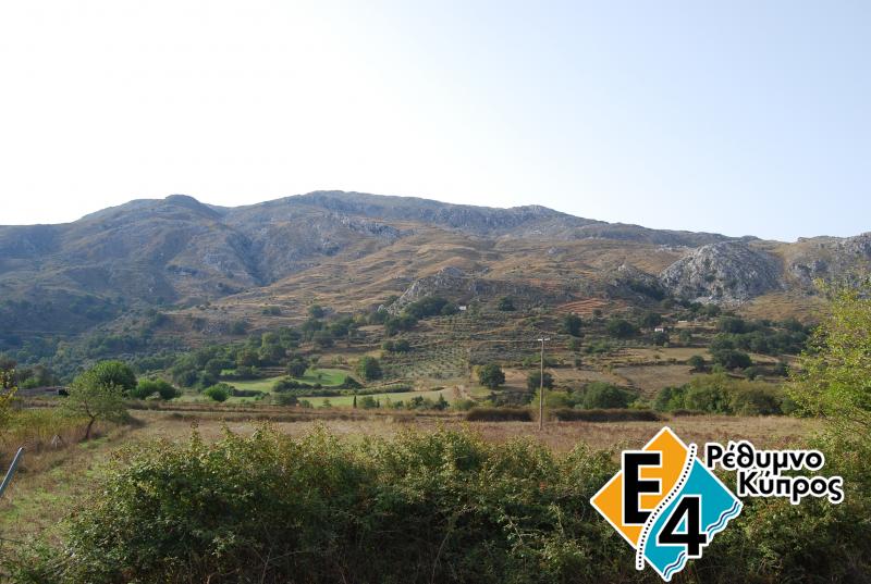
KATO POROS - MOUNTROS
At the village exit, we follow the old path, which goes up for a while and then down, manoeuvring on the slope for about 15 minutes.
Following the signs, we leave the dirt road to which the path ends up, and turn right and go down to the west bank of the river. After a few meters, we come across an old limekiln on our right.
From here, the path follows the stream bank and a little further on we come to the narrow part of the stream, where the gorge virtually begins.
After about 1 hour, we arrive at the left-east bank and begin to go up the narrow passage. When we reach the peak, we go down towards the torrent with the oleanders. There is a little cement passage like a small bridge and we go to the south bank of the stream on the dirt road, which we follow on the right towards the west for 300 m. After the small bridge, we come across the wide dirt road, which we follow for approximately 1500 m and arrive at the bridge before Velonado village.orge viryis a tomb on our left and a fence on our On our left, just before the bridge, there is a dirt road that continues parallel to the river for about 100 meters, to a point where there are big sycamore trees.
At this point, we leave the dirt road, which turns to the left, and go along the river bank until we arrive at Mountriano gorge. Always heading towards the gorge end, we walk until we see the valley of Mountros in front of us.
We leave the river bank and continue going slightly up to the old visible path, which is on the eastern side of the gorge. Approximately 1 hour and 15 minutes after entering the gorge and having met an old path going up, which we follow to the right, we arrive at Mountros village, at the church precinct.
MOUNTROS - AGKOUSELIANA
From the west exit of Mountros, at the point where there is an old fountain wit flowing water, a narrow alley begins to go up and, after crossing the village, arrives at the old primary school and then goes slightly towards the southeast, following the glacis.
The old stone-paved path passes near the country church and, 25 minutes after leaving the village, it begins to head south until the stream, to the west bank of which it leads, becomes visible.
When we arrive at the stream, the stone-paved path becomes even clearer going slightly up to the dry gorge. After 2.5 km after leaving Mountros, at the south exit of the gorge, we come across the ruins of an old watermill that answers our question about the existence of such a neat stone-paved path at an area where there aren't any houses.e across th we come across ruiros, at the south exit of the gorge, we come across ruivisible. bridge before Velonado village. At the point where the watermill ruins lie, there is a cluster of sycamore trees, immediately after which we come to the east bank of the stream and follow a dirt road, which is not kept in good condition.
After 300 m, there is a crossroad with a central part on the right and a left branch. We go straight into the central road and, after 100 m, we find a wider dirt road and take its left (north) direction.
After walking 100 m more, we turn right in another dirt road and continue straight, ignoring the two other paths until we come across a little spring with drinkable water on our right.
From the watermill until here we have already covered about 1.5 km. The landscape is treeless and only short bushes (mainly sacropoterium spinosum) cover the smooth little hills.
After the spring, we go slightly up and pass the stone-built shed form the right. On our left, between the dirt road and the oblong rocky part, there is an olive field.
A little further up, at the hill peak, we come across a stone-built house and a crossroad. We take the right direction and after the first crossroad we turn left and go down. After a while, we cross a little stream with sycamore trees and, immediately after that, we find ourselves on the bank of a second stream under huge sycamore trees.
Here is the site called "Nifis Potamia" (Bride's Rivers), where a gorgeous bride drowned while going to her wedding, according to tradition.
There is flowing water form a fountain and this is an ideal place to rest or even spend the night if the weather is favourable. Leaving the stream behind us, we continue towards the east, following the dirt road. Immediately, we come across a stone-built shed on our left and after a while we cross a little stream and follow the north direction for a short distance. Then, we head east again, until we come across a wider dirt road. We turn towards the north and west and find a crossroad after 500 m.
We take the left direction and, immediately after that, we ignore another smaller crossroad on the left and go straight on and over a stream with sycamore trees.
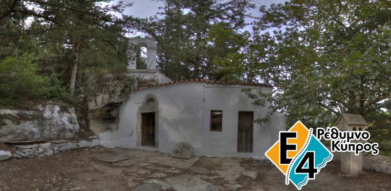
Now, the whole valley of Agios Vasileios opens up in the distance towards the east. A little further down, we come across the little church of Timios Stavros on our left hand and continue following the dirt road down to the crossroad, where there is a church on our right.
Always walking on the dirt road, we arrive near the first houses of Agkouseliana village.